Published: April 26, 2024, 3:02 PM
Hotter and earlier than last year

JACKSONVILLE, Fla. – April’s water temps are heating like rocket fuel for storms.
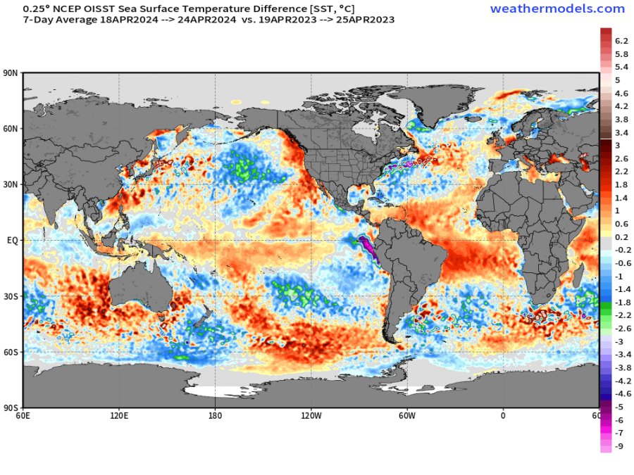
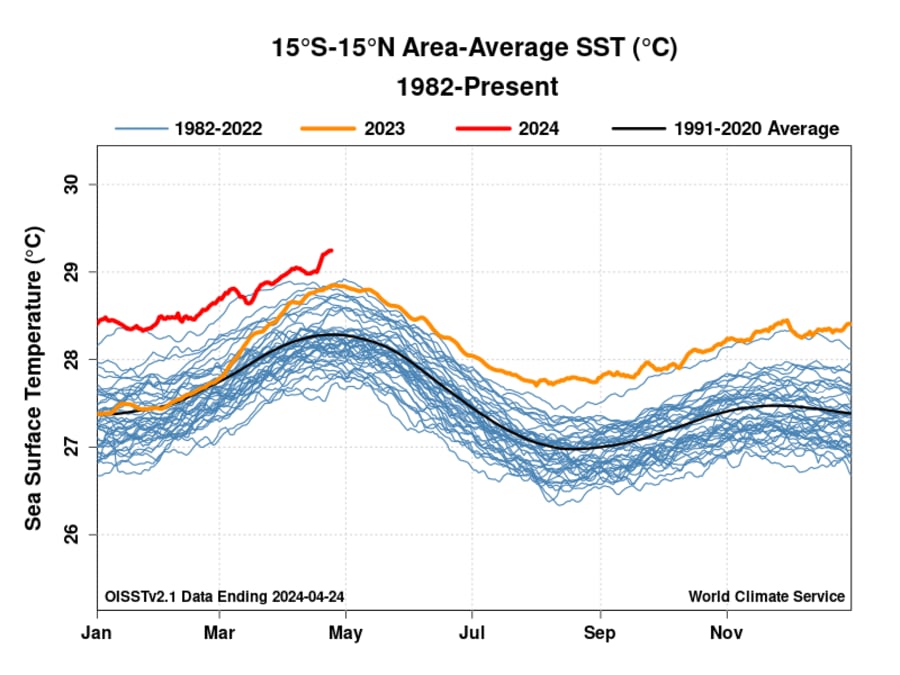
El Niño is ending, but near-equatorial water temperatures around the globe aren’t cooling off yet.
The most unusual warmth is now in the Atlantic just as the hurricane season is set to begin on June 1.
Water temperatures where most hurricanes develop in the Main Development Region of the Atlantic are currently 75F well above where they typically are in April at 70F.

The tropical Atlantic is significantly warmer this year compared to last and has reached all-time high records which leads to a greater chance for hurricane development.
And the depth of heat is important too. The Ocean Heat Content (OHC) helps hurricanes use the heat from the ocean to grow bigger and stronger. The OHC level is already at levels typically not seen until July 10.
The more heat available (more hot soup), the more energy the hurricane has to grow and become a monster storm.
These preseason conditions have resulted in an alarming number of preseason tropical cyclone predictions this season.
A University of Pennsylvania research team led by climate scientist Michael Mann is predicting the most named storms ever recorded in 2024.
Fueled by the danger of the exceptionally warm ocean temperatures and a shift from El Niño to La Niña, their forecast, released on Wednesday, predicts a range of 27 to 39 named storms, with a best estimate of 33. This could easily surpass the current record of 30 named storms set in 2020.
The announcement comes after Colorado State University (CSU) researchers, the original seasonal forecast group and generally considered the most reliable, also issued the highest number of storms in its forecast history.
The CSU forecast calls for 23 named storms in 2024, significantly higher than the average of 14.
