
Published: October 9, 2023, 10:17 AM
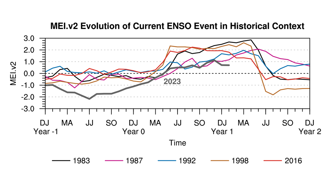
El Niño – the abnormal warming of waters centered on the equator in the eastern Pacific – continues to mature, with waters across the Niño 3.4 monitoring region topping a historically significant 1.5°C above the 30-year average.
While so far 2023 isn’t progressing as quickly as the “Godzilla” El Niño of 2015-2016 or its 1997-1998 counterpart, it is in line with other historically strong El Niños, like 1986-1987 and 1991-1992. Those strong El Niños seriously stifled Atlantic hurricane activity, with well below average activity across the board.
So far, 2023 has rejected El Niño’s typical storm squashing influence on the Atlantic, with overall activity already climbing above the seasonal average. Could that change for the season’s closing stretch?
In general, El Niño has its greatest impact on reducing hurricane activity over the western Atlantic and Caribbean, where an increase in wind shear tends to discourage storms from strengthening.
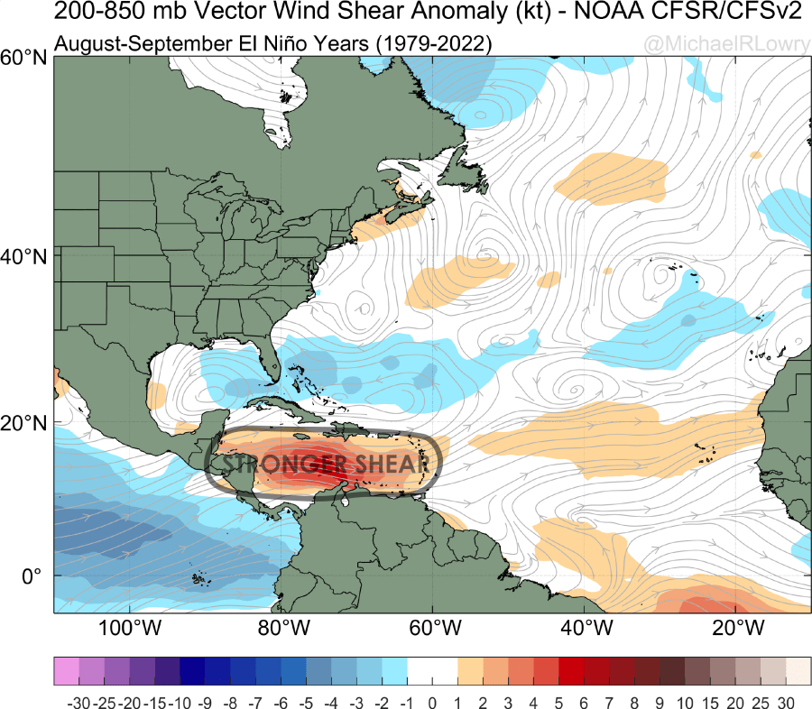
It’s no surprise then that come October and November, when activity near Africa subsides and storm formation retreats closer to home, studies show Atlantic activity is often noticeably reduced for the last two months of the hurricane season during El Niño events.
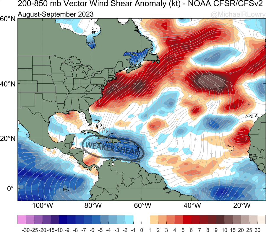
But 2023 isn’t your typical El Niño episode. It’s a year when the record Atlantic warmth is effectively counteracting El Niño’s usual influence. The result is a wind shear pattern through the Caribbean that’s so far looked anything but hostile to hurricane formation.
The question, though, is can El Niño overcome the Atlantic’s counterpunch in the final two months and soften activity in areas that sometimes breed potential South Florida hurricanes? At least according to the extended range models, we may be flying solo, without much help from El Niño in the weeks ahead. Wind shear should stay much lighter than usual through the Caribbean into the latter part of the month.
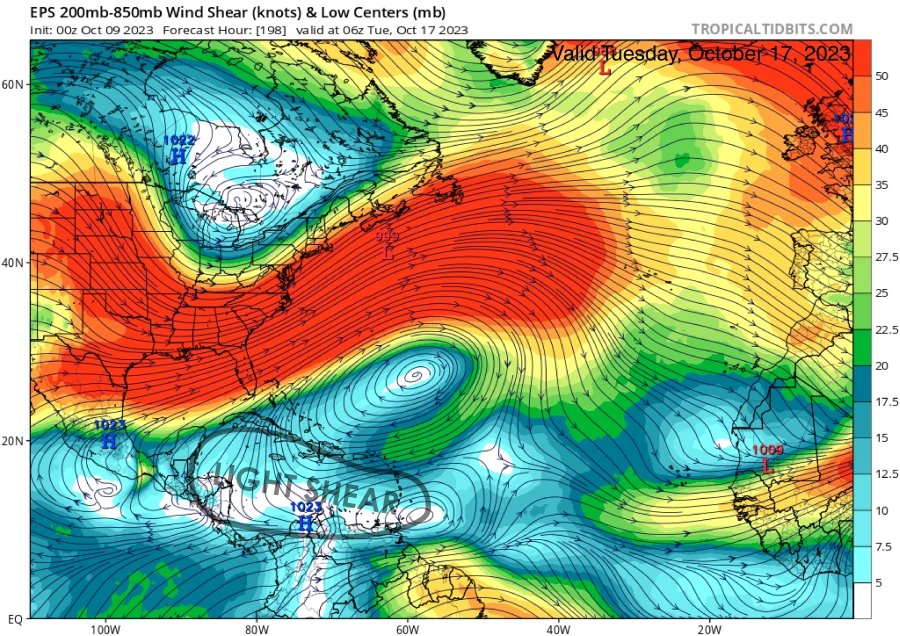
This alone doesn’t guarantee anything, and in fact, the models generally show a fairly quiet next two weeks in this area. It does mean, though, that we can’t rely on El Niño to prematurely shut things down this season. We’ll want to stay vigilant, especially through October, after which time the threat to South Florida usually drops off.
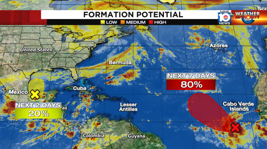
Invest 92L was designated early Saturday west of Africa. The low-pressure system is becoming gradually better organized and will likely develop into Tropical Storm Sean by mid week. The system is expected to curl up into the open Atlantic and poses no threat to land.
The National Hurricane Center is also highlighting a small area of low pressure tucked away in the extreme southern Gulf of Mexico and Bay of Campeche.
Though there’s a brief window for development with this one, it’ll quickly get tangled up with the remnants of Lidia from the eastern Pacific and a lingering front draped across the Gulf.
The combo will lead to a very messy weather system over the northern Gulf Coast into the Florida panhandle for Wednesday into Thursday. The system – albeit non-tropical – will open a rich tap of tropical moisture, producing a heavy rainfall threat along with gusty winds across the region, reaching into parts of southern Georgia and South Carolina.